
The Definitive Guide
In 2019 I decided to walk the length of the Thames Path, gradually over several stages. I completed the path (both north and south banks) on 1 August 2021. This website takes you along that path, interspersing photographs with text and other references. All the photographs from my journey along the Thames Path have been collated into videos now on YouTube which are included below. I have tried to make this, as much as possible, the definitive guide to what you will see on the path and what you are otherwise likely to miss.
The River Thames itself is 215 miles long (346 km) and begins in Gloucestershire at Trewsbury Mead and ends between Whitstable, Kent, and Foulness Point, Essex. The non-tidal Thames (from the source near Cheltenham, to Teddington) measures 147 miles (237 km). A total of 104 bridges cross over the Thames, 75 bridges over the non-tidal Thames, and 29 over the tidal Thames between Teddington and the sea.
On this website I provide detailed descriptions of the path along with associated historical links of places along the way, some of which have been taken from the sources I have listed below plus my own research.
A Very Brief History of the Thames
The Thames flows through lowland areas of the midlands, and includes 146 sites of Special Scientific Interest and two National Nature Reserves. Some 30 million years ago the Thames fed into the Rhine, but when meltwaters formed the English Channel it changed forever. The Thames was looked after by the Thames Navigation Committee between 1751 and 1866, In 1866 the Thames Conservancy took over control of the entire river from Cricklade. Management of the river went to Thames Water Authority in 1974, and then onto National Rivers Authority, and now it is managed by the Environment Agency, whose own website is here.
A much fuller account of the history, geology and workings of the Thames can be found in the wonderful “Floating Down the River” website by Dot Hart.
History of the Thames Path
The idea of a Thames Path had been around since the early 1930s as a way of joining up various towpaths that had fallen into disuse due to changes in transportation. In 1948 a proposal was put to Government, who agreed in 1949. It was some 30 years later that the River Thames Society and the Ramblers Association, worked together to produce a new proposal that was published in 1977. Its existence is due in large part to the efforts of the Ramblers, and one figure in particular – David Sharp, who led the successful campaign to establish the Thames Path.
For many decades David, who died in April 2015 aged 89, was an active group and area member in south west London, but in 1973 he represented the association at a pivotal meeting of the River Thames Society. A recreational walking route along the Thames was not a new idea, but with the withdrawal of numerous linking ferries the towpath had become truncated and a continuous walking trail seemed impossible. Amid uncertainty about a way forward, David drew a quick sketch map of what a route might look like and passed it round the table. His clarity of vision effectively sparked the Thames Path campaign. “I realised that we had to survey the route properly and really identify the problems,” he said in a matter-of-fact way. “That’s how it started.” For the next 18 months David co-ordinated survey work by Ramblers groups the length of the river to produce a 44-page report that provided clear evidence that a continuous path was possible, using existing bridges and creating new sections of path. Local authorities were vigorously lobbied, then in 1981 the Ramblers published the first ever guide to a waterside walking route that truly galvanised public support – researched and written by David, of course.
The Ramblers
Some five years later the Countryside Commission undertook a feasibility study that declared the path was feasible. The Countryside Commission “ceased to exist in 1999 when it was merged with the Rural Development Commission to form the Countryside Agency This has in turn evolved into Natural England, partly by eventual merger with English Nature” (Wikipedia).
The path was declared a National Trail in 1987, and fully opened only in 1996. The path originally extended from the source in Gloucestershire, to the Thames Barrier. The Thames Path was extended in January 2022 from the Thames Barrier to now ‘finish’ at the Woolwich Foot Tunnel. This location was chosen because it is also where the King Charles III England Coast Path enters London.
There is an extension of the Thames Path to Crayford Ness and Slade Green Railway station, where many consider to be the end – a total of 188 miles following the south bank. There is also a route along the north bank of the river from Teddington Lock but only to Trinity Buoy Wharf. The Thames Path now extends along the England Coast Path all the way to Grain. This information was published on the National Trails website in January 2022, and the route is signed with waymarkers.
John Tippetts has walked the Thames Path several times in the last few years and last year walked from Grain to Woolwich.
Sources and Resources
Perhaps a good place to start is the independent blog “The Thames Path National Trail” that aims to provide up-to-date information on the different sections of the route as well as guidance on local accommodation and transport links. It is also used as a resource by a selection of government and local council websites (such as abingdon.gov.uk, castle-eaton.com and visitrichmond.co.uk).There is a wealth of resources out there useful for planning and when undertaking the path.
a. Thames Path Specific
In walking the path, and creating this site I have extensively used the following books and guides and found them all invaluable. :
- Sharp, David, and Gowers, Tony (2016) Thames Path in the Country, Quarto
- Clapham, Phoebe (2012) Thames Path in London, Quarto.
- Newton, Joel (2015) Thames Path, Trailblazer.
- Hatts, Leigh (2016) Walking the Thames Path, Cicerone (Leigh has a website on the path here)
- AZ Adventure Series Thames Path AZ
- Gilly Cameron-Cooper (2016) Walking London’s Waterways, IMM Lifestyle Books.
- Hampson, Tim (2016) London’s Riverside Pubs, Lifestyle Books.
- I also subscribed to the Ordnance Survey OSMaps App and also the Thames Path App which provides open mapping route of the entire path.
The first two are the official National Trail Guides and are excellent. They provide full and detailed route instructions along with OS route maps – though the path is well marked throughout. They also provide transport links, historical connections and accommodation suggestions. The second is the only one that covers the Thames Path Extension going the extra 8 1/2 miles beyond the Thames Barrier up to Erith and Crayford Ness railway station, and also the very latest extension (2020) to the northern route from Greenwich to Trinity Buoy Wharf (make sure you get the latest edition).
The third, by joel Newton does not provide step by step route instructions but has some 84 excellent detailed hand drawn maps of the entire route from source to Thames Barrier, including key town centre maps with locations of restaurants, shops and hotels. Its information on shops, restaurant and accommodation along the way is particularly comprehensive.
The fourth by Leigh Hatts comes with its own route map book, but goes from Barrier to Source, and as such its detailed maps and route instructions are less helpful if you are going the other way. It does have considerable detail on sites you see along the way.
The fifth is a more handy way of having a map of the entire path in your pocket – but it does only go as far as the barrier. Thre final stretch to Crayford Ness is on OS Explorer 162. This does go as far as Gravesend, which along with OS Explorer 163 covers thre path up to the estuary in Kent.
The sixth provides 21 walks along London’s waterways, 10 of which are along the Thames between Richmond and Greenwich.
The seventh I found interesting, and did plan to visit every pub on the path. This was scotched when the very first was closed! Others didn’t open till mid-day. However this book covers most of the pub encountered in London.
The eighth I found both invaluable. The OS Map App is fabulous with detailed OS Explorer 1:25,00 scale map which actually shows where you are standing! The Thames Path App uses open street mapping so is less detailed but had the Thames Path clearly marked out so you can immediately see where to might be diverting. In London however, it only does the southern route up to the barrier.
b. Thames specific
More information on the Thames can be found from the following sources:
- The Thames Path, Wikipedia
- The Thames Path, National Trails
- List of crossings of the River Thames, Wikipedia
- List of locks on the RIver Thames, Wikipedia
- An “unofficial website” of the Thames Path
- The River Thames Society
- The Thames Explorer Trust
- The River Thames Guide
- Walking London’s Waterways
- The Thames Path in England
- Where Thames Smooth Waters Glide
- A Guide to the Thames Path in London
- Planning Your Thames Path walk
- The Thames Path in England
- Thames Pathway by Keith Palling (Also a book )
- A particularly useful book to have with you as you walk is I Never Knew That About The Thames by Christopher Winn. This book follows the river from source to Leigh-on-Sea proving a fascinating miscellany on all sites along the way.
- But possibly one of the most detailed biographies of the Thames is Peter Ackroyd’s 500 page “Thames. Sacred River“. For me though this was ”too much information”.
c. Walking Sites
Two walking sites can be found at:
- John MacDonald’s Walking Pages
- John Tippett has walked the Thames Path several times in the last few years and has put together a really good website. He has also put together a video of his 232 mile challenge to walk the Thames from Source to Sea in 14 stages to raise funds for charity. He started in May and reached Grain in Kent on August 22nd at the end of his 14th Thames walk. The video is on YouTube (https://www.youtube.com/watch?v=8cJYGzcyGPI)
- Gladys Perrier is an amateur photographer, and has a website called “Perrier Pictures“. On there she has documented her walk along the Thames Path from the Source to (at the moment) Hampton Court.
- Walk the Thames – Thames Path Distances gives the distances from the source to over 90 key points up to the Barrier.
- The Londonist – Erith to Greenwich
- Macs Adventure
- Heather Hummel has a website for when she walked the Thames Path in 2016 from the source to the Barrier on the south bank.
- John Rogers has a series of videos of London walks including two of the Thames Path: Waterloo to Putney, Putney to Richmond,
- There is a video on You Tube titled London Night Tour: A Walk along the River Thames which is an hour walk along the river at night.
d. Art and Photography
A good photo gallery of the Thames in London is Thames Path Gallery by Rambling Man.
For those interested in art:
- Doug Myers paintings of all the Thames bridges
- Terry Scales paintings of the changing Thames
- John Tippets has walked the path several times and has a Flikr account with hundreds of photos
Many more links can be found on Dot Hart’s webpage.
e. Pub Specific
I had the plan to visit every pub on the path. This collapsed on the very first one, that was closed long term for refurbishment. However, it is unrealistic since often starting walking each day around 8am, many pubs (even in London) were closed until mid-day. However, a useful guide is
The 83 pubs in here cover all the pubs you are likely to encounter from The Swan at Walton-on-the -Thames, to the Anchor and Hope at the Barrier, and The Gun on the Isle of Dogs.
f. Walk London
There is a website called Walk London, which provides a series of circular walks through London many of which cover areas on the Thames Path including Westminster, Port of London, City of London. and several others.
g. Books
The classic “Three Men in a Boat” by Jerome K Jerome, although over 100 years old, documents a fictional journey upstream from Kingston-upon-Thames to Oxford. I had avoided reading it, thinking it was a bit dated and twee. However, I relented for the second stage and found it really quite funny in places. More recently (2012), The Three Men in a Boat Companion, by Stephen Lambe, looks at the Thames in 1888 and 2000s with photographs comparing scenes from the book with those of today.
A more recent account of a walk along the Thames path “From Source to Sea” is by Tom Chesshyre, (@tchesshyre). Tom walked the path in June 2016 and went right along to the Isle of Grain in Kent where the Thames meets the North Sea – 215 miles in all. The final stage, from Erith to the Isle of grain is unfinished and difficult to follow, and in 2021 is still under planning as part of the English Coastal Path proposals.
In reading his book I realised we stayed in four of the same hotels, had the same missing breakfast experience in The George in Pangbourne, and drank in 20 of the same pubs. I wondered why I too hadn’t managed to write 300 pages on my experiences. Until that is, I read his website:
TOM CHESSHYRE is the author of eight travel books that have taken him from Hull to Tripoli via assignments in North Korea, Nepal, India and Iceland. He has contributed to the The Times, The Guardian, The Financial Times, The Times Literary Supplement, The Daily Mail and The Mail on Sunday. His magazine work has been for National Geographic Traveller, Geographical and Condé Nast Traveller. On his travels he has been hijacked in Africa, met tornado-chasers in America and followed in the footsteps of Graham Greene in Haiti.
http://www.tomchesshyre.co.uk/biography/
Mind you, there isn’t one photograph in his book, so I have the edge there.
h. Google Maps
Most people will know of Google Maps and Google Street View, which I have used quite a bit putting this site together. Much of the Thames Path, though not all, can be accessed and followed on Google Street View. In fact the very room in the Thames Head Inn which I stayed in at the very beginning is here. And the source of the Thames where the walk officially begins is here. You could follow the path without leaving home!
However a lot of the time I did repeatedly find stretches of the Thames Path has been mapped by someone call Uy Hoang. Uy Hoang is a public health researcher who is 90% of the way through mapping the entirety of the Thames. He has uploaded over 150,000 photos to Google Streetview and has 400 million views. I owe him many thanks for providing me with views over parts I had overlooked on my own walk. There is a YouTube video of his work here.
i. Accommodation
Here is a list of accommodation I used in walking the Thames Path, both south and north bank routes. I used Move My Bags (07400023230) to transport my suitcase each day and have included the 2020-2022 costs. All of these are very comfortable and close to the river, many overlooking the river itself – apart from The Elephant in Pangbourne and the Best Western Plus in Vauxhall. I don’t think there is anything close to the bridge at Pangbourne. I am sure there is a better more convenient hotel/pub close to the north bank of Vauxhall Bridge, I just didn’t find it. The cost in 2021 was all in the range £70 – £150 per night including breakfast, though some may be ,more now (Compleat Angler for example). All offered breakfast apart from The George, Windsor (there is a Costa opposite that opens very early. When I got to Crayford Ness, rather than stop, I took a train back to Teddington via Waterloo, and stayed in Teddington to complete the north bank route from Teddington to Trinity Buoy Wharf over three days.
See also: Uy Hoang – film productions and visual work – Hoang
Walking Holidays
A number of people and companies offer holidays walking along the path including:
- Walk the Thames offers bespoke walking holidays
- Macs Adventure offer Thames Path holidays. See especially the 19 day walk)
- Rambling Man is a great website by Andrew Bowden that offers help and guidance
- Mickledore Holidays will put a trip together for you
- Contour Holidays
I have not used any of these and so cannot endorse or recommend any.
Panorama of the Thames Project
There is a fabulous Thames Panorama Project being created:
The Panorama of the Thames conservation project is creating a unique and enduring historical record of the banks of the river through Great Britain’s capital city, London. It contains spectacular panoramic images and videos, accompanied by an extensive database to cover every feature along 52 miles of rapidly changing riverbank. Funded mainly by individual contributions and community groups, the project shows the built and the natural environment along the river, as you would see it at its best. It includes a fully restored version of a rare publication which depicts the Thames riverside in 1829, at the end of the Georgian period. This website, provides public access to some of the material from this massive, ongoing project.
Panorama of the Thames Project
Stages of the Thames Path
The entire 180 mile path is usually broken up into several stages roughly as follows – the first four being the official Thames Path. Stage 5 is the Thames Extension (See here by Leigh Hatts and here). Stage 6 is still under development.
- Stage 1 – Source to Oxford (53 miles)
- Stage 2 – Oxford to Henley-on-Thames (50 miles)
- Stage 3 – Henley-on-Thames to Hampton Court (45 miles)
- Stage 4 – Hampton Court to Thames Barrier to Slade Green* (south bank) (70 Miles)
- Stage 4a – Teddington to Trinity Buoy Wharf (north bank) (23 miles)
- Stage 5 – From Erith to Grain (under development) (30 miles)
*Between Teddington Lock and Greenwich the path includes both the “official” south bank route (27 miles) and the additional north bank route (29 miles), plus the extra 8 miles to Slade Green. In total 243 miles.
Luggage
One concern for the long distance walker is what to do with your luggage. I am not a camper, and preferred the comfort of a room in a pub after a long day’s walk. I solved the problem of my what to do with my suitcase by using Deep Kapur of Move My Bags. Deep was extremely helpful, well organised and efficient. He managed to move my bag every day, using local taxis, so that it was already at my destination when I arrived – in some cases already in my room. The cost for four transfers of my 20kg bag (yes, it really was that heavy!) was around £130, though the price does rise as you get into London.
Beyond London
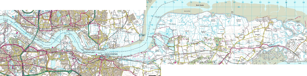
The official National Trail ends at the Thames Barrier, but the Thames Path Extension goes round to Erith and Slade Green. But of course the Thames goes as far as the Thames Estuary with the North Sea. At Slade Green, the path gets cut off by the River Darent. This requires a walk to Crayford, and along roads to Dartford to pick up the path on the east bank of the Darent. See OS Explorer Maps 162 (Greenwich and Gravesend) and 163 (Gravesend and Rochester), which take you along the Hoo Peninsular to All Hallows.
It is also possible to walk on some of the north bank of the River Thames from Tilbury to Leigh on the Thames Estuary Path. This is described by Diamond Geezer here. You can follow this path on Twitter (@thames_estuary). Maps are at Thames Estuary Stage 1 and Thames Estuary Stage 2. Though this path is a world away from the Thames Path.
Photography
Part of my interest in doing the path was to create a photographic record, which I think i have now done. In this site there are some ?? photographs from the Thames Head Inn down to Slade Green (on the south path) and Trinity Buoy Wharf (on the north path). This of course slowed me down, because as Ansel Adams once said, the art of taking a good photograph is knowing where to stand. In many places I was limited, and I usually had to composed a photographed more or less where I happened to be.
On looking through the photographs a friend commented “where are all the people?” Well, I did my best to minimise the number of people – and … .it took some patience, and just a 1/250th of a second gap most of the time …..
I used a Nikon D5600 with a Nikkor 18-300 mm lens and Cokin graduated neutral density filters.
Virtual Trip
Much of the Thames Path, though not all, can be accessed and followed on Google Street View. In fact the very room in the Thames Head Inn which I stayed in at the very begining is here. And the source of the Thames where the walk officially begins is here. You could follow the path without leaving home!
Stage 1 – Source to Oxford
The Thames Path follows the River Thames from its source in rural Gloucestershire to beyond the Thames Barrier – almost 200 miles in all. There is also an extension for 8 miles onto the estuary at Crayford Ness. My plan is to do it all in 4-5 stages, each stage including four walking days.
Scenes of the path from Stage 1 – Source to Oxford have been collated into this 15 minute video:
This first stage took four days and each day is described in detail by clicking the links below:
- Day 1 – Source to Cricklade
- Day 2 – Cricklade to Lechlade
- Day 3 – Lechlade to Newbridge
- Day 4 – Newbridge to Oxford
This first stage is memorable for the growth of the river from a trickle to a navigable river and the relative seclusion you find along most of the route.
Stage 2 – Oxford to Henley
I started walking the Thames Path on Monday 16th September 2019 (See above) and after 53 miles, I got to Oxford on Friday 29th September 2019 via Cricklade, Lechlade and New Bridge. The Coronavirus pandemic halted any further attempt from March 2020 until August 2020, when hotels had reopened. I started this stage on Monday 10th August 2020 and got to Henley on Friday 15th August 2020.
This second stretch of the path would take me the 50 miles from Oxford (see here) to Henley-on-Thames via Abingdon, Wallingford, Pangbourne. Unlike the first stage, Stage 2 brings the walker into reasonable sized market towns, and ultimately into Henley, and the site of the annual regatta.
The photographs of this Stage 2 – Oxford to Henley-on-Thames has been made into a 20 minute video:
This stage took four days and each day is described in detail by clicking the links below:
- Day 5 – Oxford to Abingdon
- Day 6 – Abingdon to Wallingford
- Day 7 – Wallingford to Pangbourne
- Day 8 – Pangbourne to Henley-on-Thames
Unlike Stage 1, this stage finds the river much busier and fully navigable, with narrow boats and cruisers, as well as the occasional canoe and kayak.
Stage 3 – Henley to Hampton Court
I was keen to get as much of the path completed before the weather got worse for walking, so started this Stage on 21st September 2020 and reached Hampton Court on Friday 25th September 2020.
All the photographs of this stage have been made into a 30 minute video, now on YouTube.
The stage took four days and each day is described in detail by clicking the links below:
- Day 9 – Henley-on-Thames to Marlow
- Day 10 – Marlow to Windsor
- Day 11 – Windsor to Chertsey
- Day 12 – Chertsey to Hampton Court
This stage was significant different from Stages 1 and 2 in that it included gradually less and less open space, and more populated towns and cities (Henley, Marlow, Windsor, Reading, Maidenhead) – even if these are usually skirted round. Consequently, there is much more to see and more to write about.
Stage 4 – Hampton Court to Thames Barrier and onto Slade Green (South) and Teddington to Trinity Buoy Wharf (North)
Further lockdowns delayed the fourth stage until 25th July 2021 as the warmer weather and longer days arrive and the lockdown eases. The “official” national path ends at the Thames Barrier in Greenwich, but the “extension” now exists east to Erith and Slade Green. This is because the path is interrupted by the River Darent, requiring a significant detour, and so seems a convenient place to stop. It is now possible to go further and follow The Thames round to the North Sea – see Stage 5 below.
This stage is quite different from the previous three and required a lot more preparation and preparatory reading to make sure I knew what I was going to see. From Kew Bridge the pace of interest hotted up considerably with monuments, buildings, bridges, and history appearing round every corner. In addition, I would pass near to the church of St Giles Cripplegate in the Barbican, where my earliest known ancestor, Thomas Gates, took his newborn son, William to be baptised in 1565.
So, on 25th July I took the train from Nottingham through London to Hampton Court and checked in at the Kings Arms Hotel. I decided to do both south and north routes while I was here and so followed the south route all the way to Slade Green, then came back to Teddington, where north and south split, and walked to Greenwich along the north bank. Unlike the four days that the previous sections had taken, this took me seven because of the three extra days along the north bank. Each day is described below along with photographs and video.
- Day 13 – Hampton Court to Kew Bridge
- Day 14 – Kew Bridge to Vauxhall Bridge (South)
- Day 15 – Vauxhall Bridge to Thames Barrier (South)
- Day 16 – Thames Barrier to Slade Green
- Day 17 – Teddington Lock to Kew Bridge (North)
- Day 18 – Kew Bridge to Vauxhall Bridge (North)
- Day 19 – Vauxhall Bridge to Trinity Buoy Wharf (North)
Stage 4 Videos
Unlike the pervious three stages, for this stage, each day has its own video as there is so much to see.
Day 13 – Hampton Court to Kew
Day 14 – Kew to Vauxhall (South)
Day 15 – Vauxhall to Thames Barrier (South)
Day 16 – Thames Barrier to Slade Green
Day 17 – Teddington to Kew (North)
Day 18 – Kew to Vauxhall (North)
Day 19 – Vauxhall to Trinity Buoy Wharf
Transport for London Guides
Transport for London has a website on the Thames Path which includes downloadable guides for each section from Hampton Court/Teddington Lock to Crayford Ness on both North and South banks.
North Bank
- Hampton Court to Albert Bridge (pdf)
- Albert Bridge to Tower Bridge (pdf)
- Tower Bridge to Island Gardens (pdf)
- Island Gardens to East India Dock (pdf)
South Bank
- Teddington Lock to Albert Bridge (pdf)
- Albert Bridge to Tower Bridge (pdf)
- Tower Bridge to Thames Barrier (pdf)
- Thames Barrier to River Darent (pdf)
Stage 5 – To the Medway??
This stage might have to wait. It is however covered in Tom Chesshyre’s book From Source to Sea on pages 264-294.
Peter Gates
Last updated September 2022